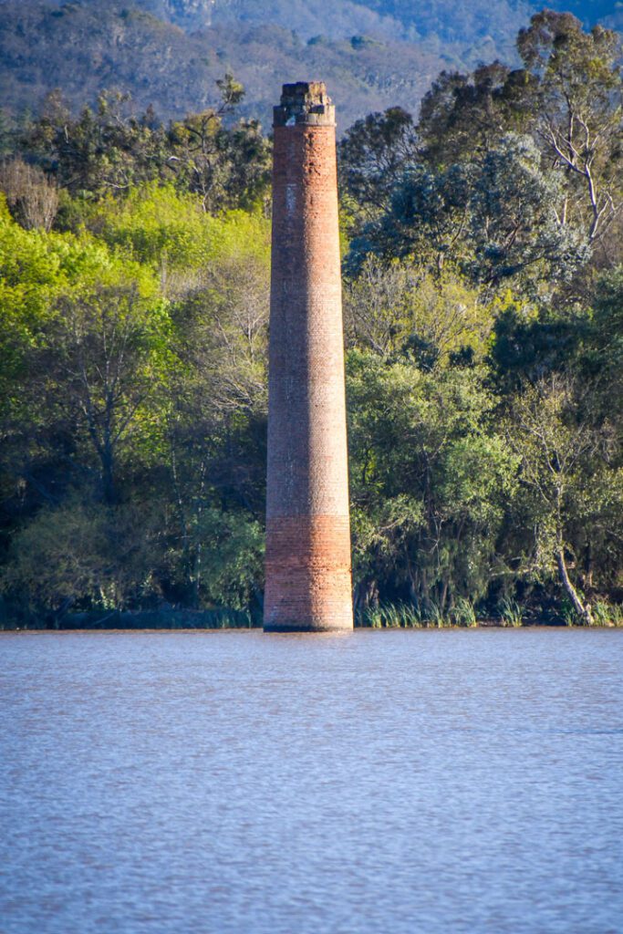
Dam in santa maría regla, in Huasca de Ocampo, vestiges such as a chimney and a tower are observed above the dam
LOCATION IN GEOGRAPHICAL COORDINATES
20°13’59.03″N, 98°33’53.07″O
MUNICIPALITY
Huasca de Ocampo
Ejido
Santa María Regla
DATE
In 1922, a plain encompassing the Hacienda de San Antonio Regla was flooded to create this body of water.
GEOSITE DESCRIPTION
Under the water of the dam lie the remains of a mining hacienda that was flooded in 1922 due to a failure in the hydroelectric plants. Visible vestiges include a chimney from a mineral smelting system of a processing hacienda (chacuaco) and a small tower.
The former hacienda of San Antonio Regla was founded between 1760 and 1762 by Pedro Romero de Terreros, Count of Regla, to process silver. In 1922 it was flooded to give more water flow to the dynamos of the hydroelectric plants that were at the bottom of the Barranca de Metztitlán.
LOCATION
HOW TO GET THERE?
To get there by car from Mexico City take the Mexico-Pachuca highway to Tulancingo and then take the detour to the Magical Town of Huasca de Ocampo where the hacienda is located.