These geological formations are part of the pliocene zumate formation
LOCATION IN GEOGRAPHICAL COORDINATES
20° 9’59.85″N, 98°39’10.04″O
MUNICIPALITY
Omitlán de Juárez.
Ejido
Puentecillas.
GEOLOGIC PROVINCE AND AGE
Pliocene (2.6 to 5.3 million years).
GEOSITE DESCRIPTION
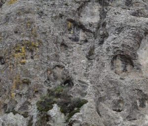
Monolith that is part of the Zumate crag, originated during the Pliocene.
Peña El Comal and Peña del Diablo are volcanic domes on the periphery of the municipal capital. The Peña El Comal is visible on the road to Atotonilco and Huasca de Ocampo, currently it has become a viewpoint and to reach it there are 216 steps up from the town of Omitlán. The Peña del Diablo is located next to the municipal market.
GEOLOGICAL ELEMENTS
The Peña del Diablo and Peña El Comal are part of the Pliocene Zumate Formation, rocks of dacitic and rhyolitic composition, with plagioclase, quartz and biotite as characteristic minerals. These rocks have undergone a natural weathering process in which feldspars and biotite are replaced by chlorite (chloritization), resulting in some greenish fragments.
LOCATION
Piedra del Comal
Peña del Diablo
HOW TO GET THERE?
Take the road to Real del Monte and reach Omitlán, both geosites can be visited on foot, especially Piedra del Comal, which has steps that lead up to it. Approximate driving time is 32 min.