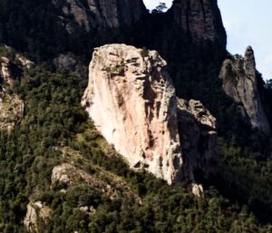
The formation resembles a nun, which has led the local population to believe that it is the petrification of a nun as punishment for her bad deeds.
LOCATION IN GEOGRAPHICAL COORDINATES
20°12’37.78″N, 98°45’25.37″O
MUNICIPALITY
Mineral del Chico
Ejido
Varios
GEOLOGIC PROVINCE AND AGE
Between 3 and 5 Myr They are part of the province of the Trans-Mexican Volcanic Belt.
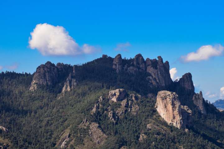
Peñas Las Monjas
GEOSITE DESCRIPTION
Geological site located to the west of the Comarca Minera, its peculiar shape is due to the action of physical and chemical weathering to which the extrusive igneous rocks were exposed. Its name derives from the resemblance of the geoform with the habits of some nuns that move away from the municipal capital. The local belief is that the geoform resulted from the petrification of nuns who were leaving town. These narratives contribute to the intangible cultural heritage of the mining region.
GEOLOGICAL ELEMENTS
Its peculiar shape is due to the action of physical and chemical weathering and the erosion of exposed extrusive igneous rocks. These rocks have an intermediate and acidic composition in the form of volcanic domes. Deposits of pyroclastic flows (tuffs) and lava flows are also observed, products of the effusive and explosive igneous activity present in the region.
LOCATION
HOW TO GET THERE?
In the town of Mineral del Chico there a road leads to the park and trails where they are located.