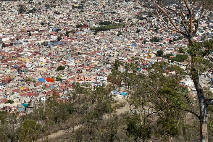
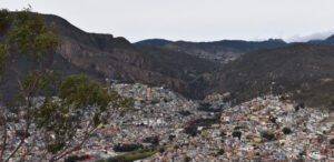
The cerro del lobo viewpoint is in the heart of the comarca minera in the city of Pachuca.
LOCATION IN GEOGRAPHICAL COORDINATES
20° 7’21.56″N, 98°43’31.42″O
MUNICIPALITY
Pachuca de Soto
NEIGHBORHOOD
Las Lajas
GEOLOGIC PROVINCE AND AGE
Between 2 and 5 million years. Province of the Trans-Mexican Volcanic Belt.
Mirador Cerro del Lobo
GEOSITE DESCRIPTION
This hill is located in the heart of the Comarca Minera, from where the city of Pachuca can be observed. It is distinguished by its rich geological composition and in its interior, there are old tunnels of different mines. In this area, it is possible to find a variety of andesitic volcanic materials.
In addition, the area is marked by the footprint of mining activity, evident in the municipalities of Mineral de la Reforma and Pachuca. The mining districts and the architectural remains of 17th century mines are testimony to this rich mining history.
GEOLOGICAL ELEMENTS
This geosite hosts a series of geological outcrops that are an integral part of the Pachuca Group.
LOCATION
HOW TO GET THERE?
To get there, take the old highway to Real del Monte until reaching the highway intersection to enter the El Lobo Ecological Preservation Zone. The estimated driving time is 9 minutes.