It was built in 1940 to accumulate water from the mountain slopes.
Presa El Cedral
GEOSITE DESCRIPTION
This is one of the oldest parks in Mexico
It was built in 1940 to accumulate water from the mountain slopes.
It is located on the west side of the Comarca Minera, in the municipality of Mineral del Chico. It houses a dam at 2780 meters above sea level, which was built in the 1940s as a water containment measure after a flood that devastated Pachuca. Today, the dam is used for trout farming (both rainbow and salmon trout) and recreational activities.
2780 metros sobre el nivel del mar, que se construyó en la década de 1940 como medida de contención de las aguas tras una inundación que arrasó Pachuca. Hoy en día, la presa se utiliza para la cría de truchas (tanto arcoíris como asalmonada) y para actividades recreativas.
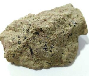
GEOLOGICAL ELEMENTS
Regarding its geology, the dam is located on rhyolites, dacites, breccias, basalts, andesites and tuffs.
BIOTA TO WATCH
A cedar, pine and fir forest surrounds the dam and is home to various species such as gray fox, cacomixtle, tlacuache, armadillos, hawks, eagles, woodpeckers, salamanders, mountain chameleon and rattlesnakes.
LOCATION
HOW TO GET THERE?
From Pachuca de Soto take the road to Mineral del Chico and follow the road towards Estanzuela. The estimated driving time is 27 minutes.