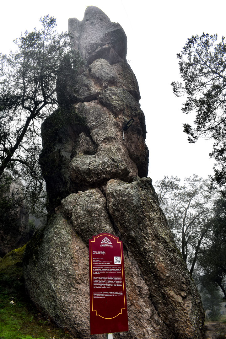
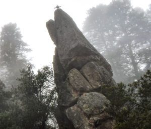
Located 2800 meters above the sea level in the ejido Xoloxtitla, these structures are remnants of an explosive eruptive event.
LOCATION IN GEOGRAPHICAL COORDINATES
98°33’6.96″O, 98°37’34.44″O
MUNICIPALITY
Mineral del Monte
Ejido
Xoloxtitla
GEOLOGIC PROVINCE AND AGE
Pliocene Rocks 5 Myr Trans-Mexican Volcanic Belt (Neovolcanic Axis).
GEOSITE DESCRIPTION
Located at 2800 meters above the sea level.
Its name is due to its capricious pinacoid structures approximately 80 meters high, these are the product of physical and chemical weathering, of atmospheric agents, on the volcanic structures over millions of years. These structures of rhyolitic composition are part of effusive volcanic activity that formed volcanic domes, which were later exposed to physical and chemical weathering that originated their capricious forms.
GEOLOGICAL ELEMENTS
Capricious forms of fractured rocks, superimposed on each other, the product of physical and chemical weathering over millions of years.
BIOTA TO WATCH
In this geosite it is possible to see a rich diversity of flora and fauna, including pines, oaks, oaks, oyamel fir, mushrooms, wildflowers, insects, reptiles, amphibians, birds and mammals. Of the latter there are rabbits, hares, squirrels and a good variety of flying land birds, generally small, of the order of birds.
LOCATION
HOW TO GET THERE?
To get there, take the highway to Real del Monte. Once there, take Avenida Juárez heading east to Real del Monte towards Peñas Cargadas. The estimated driving time is 42 minutes.