Protected natural area proposed to counteract human pressure on Cerro de Cubitos
LOCATION IN GEOGRAPHICAL COORDINATES
20° 5’57.45″N, 98°44’5.59″O
MUNICIPALITY
Pachuca de Soto
NEIGHBORHOODS
Cubitos, La Raza, Fraccionamiento Bosques del Peñar y Adolfo López Mateos.
GEOLOGIC PROVINCE AND AGE
Trans-Mexican Volcanic Belt (Neovolcanic Axis). Age 5 Myr.
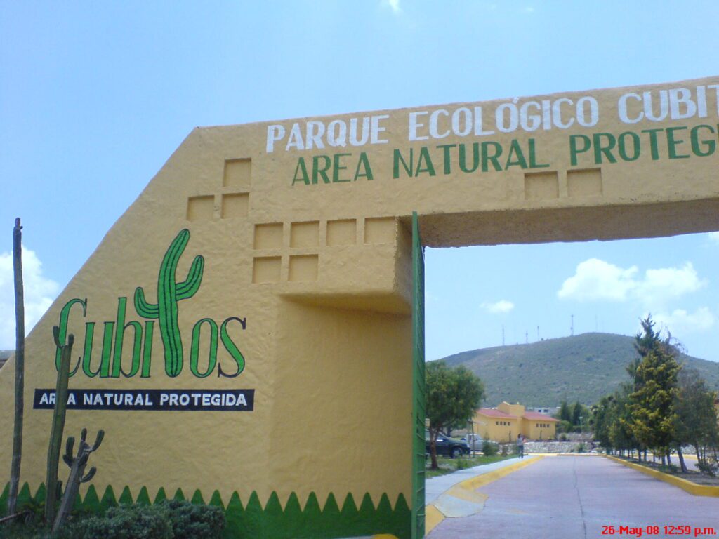
GEOSITE DESCRIPTION
They are located in the Cubitos Ecological Park, located in the southwestern part of Pachuca. This geosite offers a recreational, cultural and educational alternative. From a geological standpoint, it is possible to observe the contact zone between the San Cristóbal formation composed of dense andesite and olivine and deposits of pyroclastic flows from the Pliocene. The Cubitos Tuff (pyroclastic flow deposits) is from the Middle Pleistocene.
It encompasses the neighborhoods: Cubitos, La Raza, Fraccionamiento Bosques del Peñar and Adolfo López Mateos.
GEOLOGICAL ELEMENTS
From a geological standpoint, there is an intersection between the Pliocene San Cristóbal Formation, composed of andesitic lava flows with olivine and Pliocene pyroclastic deposits, and the Middle Pleistocene Cubitos Tuff.
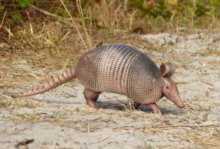
BIOTA TO WATCH
There are 133 species of plants in the geosite, including xerophytic scrub. There are also amphibians, reptiles, birds and mammals such as squirrels, gophers, voles, field mice, armadillos and several species of birds.
LOCATION
HOW TO GET THERE?
The park is located in the urban area of Pachuca de Soto. To get there, take Viaducto Nuevo Hidalgo, Viaducto Río de las Avenidas, Boulevard Everardo Márquez and the Bulevar Panorámico towards the López Mateos neighborhood.
The estimated driving time is 21 minutes.
SERVICES
Visit guides, information booth, security, educational facilities, restrooms.