It was built under the direction of Fray Juan de Sevilla between 1542 and 1562.
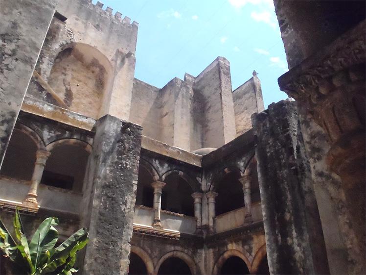
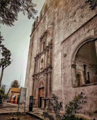
The Convent of San Agustín was founded in 1536, in response to the need to begin evangelization work in the region where Otomí Indians predominated. The main construction was carried out by Fray Juan de Sevilla between 1542 and 1562. The façade of the temple exhibits a rather austere plateresque style, with paired columns in the lower part and medallions of St. Peter and St. Paul over the main entrance and a singular open chapel. Inside, the side chapels and the presbytery stand out, with a Gothic style ribbed vault.
The name Atotonilco has its origin in the words atotonil-li, meaning “thermal water”, and co, meaning “in”, which indicates the presence of active geological processes and reflects the fusion between religiosity and pre-Hispanic traditions.
LOCATION
HOW TO GET THERE?
From Pachuca take the Corredor de la Montaña highway to Atotonilco el Grande, the convent is located in the center of the town.