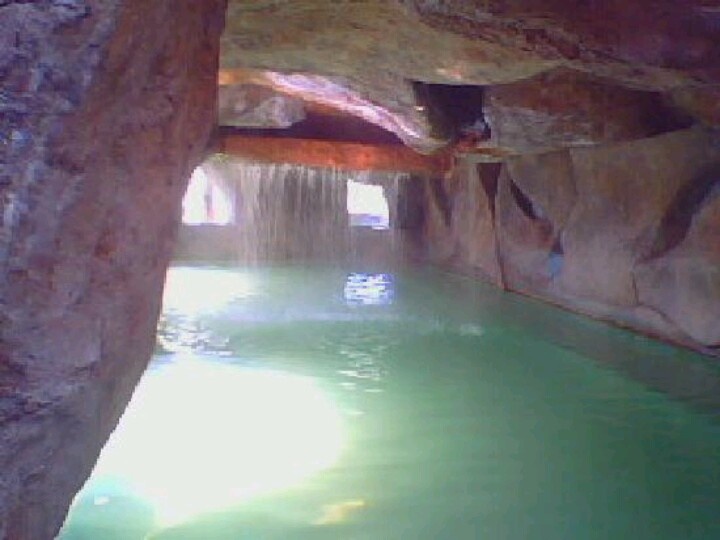
Geosite in the extreme north of the comarca minera, in the municipality of Atotonilco el Grande known for its hot springs
LOCATION IN GEOGRAPHICAL COORDINATES
20°18’23.56″N, 98°42’52.39″O
MUNICIPALITY
Atotonilco El Grande.
Ejido
Santa María Amajac.
GEOLOGIC PROVINCE AND AGE
Volcanic Belt of Folds and Faults. 100 and 145 Myr.
GEOSITE DESCRIPTION
Geosite known for its thermal waters whose origin is attributed to the contact of groundwater with hot igneous bodies in the subsoil. The waters and gases produced from this contact flow to the surface through faults and fractures in the rocks; this allows high-temperature hot springs to exist.
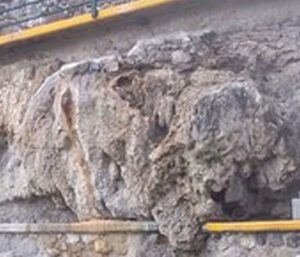
GEOLOGICAL ELEMENTS
Limestone outcrops with calcite veins of the El Abra Formation can be observed in the geosite. The deposits of the limestone rocks are of a post-recific type with abundant fragments of benthic organisms such as starfish and sea urchins, oysters, corals, etc. The geosite borders the Atotonilco Formation, composed of clastic rocks (conglomerate, sandstone, limonite and shale) with intercalations of in situ volcanic ash and transported pyroclastic deposits.
LOCATION
HOW TO GET THERE?
To get there, take the road to the Montaña corridor heading to Real del Monte, continue along the road towards Atotonilco el Grande, pass the bypass and take the detour to Santa María Amajac. The estimated driving time is 56 minutes.