Sedimentary rocks 100 Myr and volcanic rocks 3 Myr
Aguacatitla
Canyon
GEOSITE DESCRIPTION
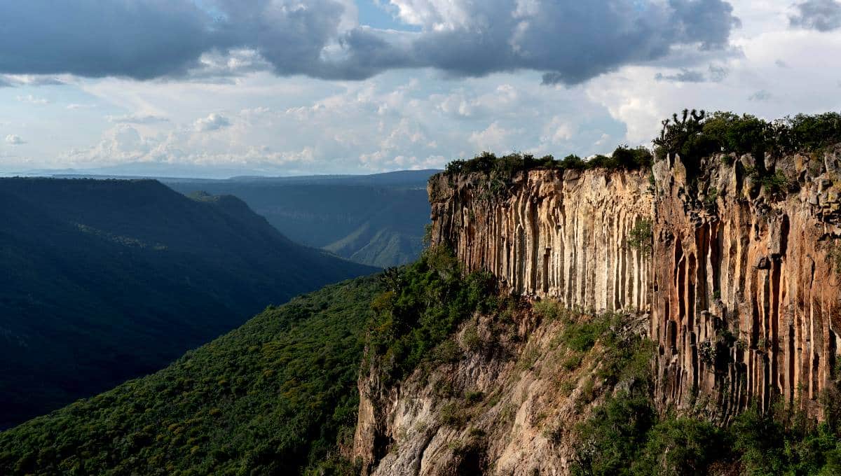
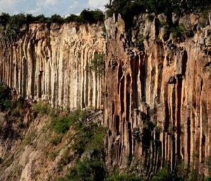
Barranca de Aguacatitla is an ecotourism center that is part of the Barranca de Metztitlán Biosphere Reserve. From this geosite it is possible to observe the boundary between two physiographic provinces: the Trans-Mexican Volcanic Axis, made up of volcanic rocks such as basalt, and the Sierra Madre Oriental, formed by sedimentary rocks such as limestone, shale, sandstone and siltstone. The sedimentary rocks are rich in marine fossils with a Cretaceous age of 100 Myr. The last geologic activity recorded in the area corresponds to the Quaternary period (2.5 million years ago), with basaltic rock spills.
Photo: Cavan-Images/Shutterstock.com
GEOLOGICAL ELEMENTS
The geological contrast (volcanic and sedimentary rocks) that shows the contact between the two geological and physiographic provinces of the Comarca Minera can be appreciated. The area offers an attractive landscape diversity derived from its marked variations in altitude, precipitation and temperature, linked to the geological substratum.
BIOTA
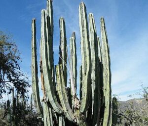
There is coniferous forest, oak forest, mountain mesophyll forest, xerophytic scrub, mesquite and deciduous forest. Representative species of flora include: mesquite, nopal (prickly pear cactus), viejito, acacia, colubrina, hinchador, candelabro cactus and pitayo. The representative fauna includes foxes, skunks, cacomixtles, vultures, coyotes, sparrow hawks and white herons.
LOCATION
HOW TO GET THERE?
From Pachuca take the Corredor de la Montaña highway to Huasca de Ocampo. Once in Huasca de Ocampo take the road to San Miguel Regla, pass by the San Antonio Dam and take the detour to Aguacatitla. The estimated driving time is 57 minutes.