Trans-Mexican Volcanic Belt (Neovolcanic Axis). Tertiary 5 Myr
GEOSITE DESCRIPTION
El Chico National Park is a Protected Natural Area with national jurisdiction located in the central-western part of the Comarca Minera. It is a natural mosaic that amalgamates significant physical and biological features embodied in geoforms of great scenic beauty such as crags, valleys and ravines. The tertiary volcanic origin of its rocks, its altitude, morphology and its exposure to the environment caused the development of recent and little evolved soils where abundant vegetation has grown.
The park borders the town of El Puente to the northwest; to the north with ejidos of San José Zoquital; to the northwest with ejidos of the ranchería Carboneras; to the southwest with the community of La Estanzuela; to the south with the Jaramillo dam and the town of San Miguel Cerezo, and to the southeast with the ejido Pueblo Nuevo.
GEOLOGICAL ELEMENTS
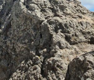
The current relief of the Park constitutes an east-west alignment, built by Tertiary volcanic activity that consists of lava flows, breccias and volcanic conglomerates and tuffs (pyroclastic flow deposits). These rocks and deposits are part of the Vizcaína, Cerezo and Zumate Formations, belonging to the Pachuca Group.
LOCATION
HOW TO GET THERE?
Leaving the city of Pachuca, take the Boulevard Luis Donaldo Colosio, then follow the highway to Actopan and the detour to Tilcuautla and finally continue on the highway to Mineral del Chico. The total estimated driving time is 28 minutes.
SERVICES
It has a visitor center that provides some facilities.